Two people have died and more than 100 have been left stranded after an earthquake near Malaysia's highest peak, officials say.
The bodies of a local guide and a 12-year-old Singaporean girl were recovered from Mount Kinabalu, on the island of Borneo, local media say.
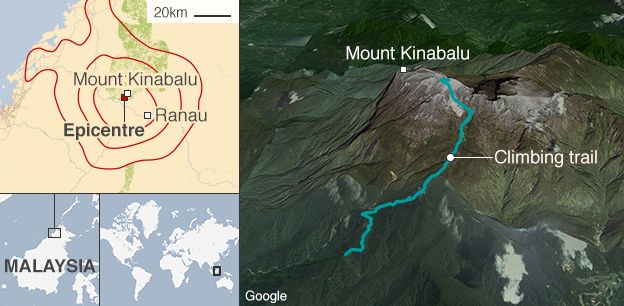
The 6.0 magnitude earthquake triggered landslides, trapping 137 climbers on the mountain.
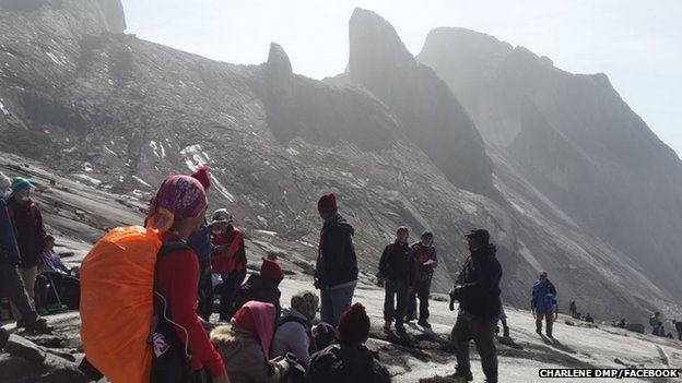
Many have been trying to descend with the help of park rangers and guides.
Police chief Jalaluddin Abdul Rahman confirmed the two fatalities but would not give any further details.
Initial attempts to rescue the survivors, some of whom are trapped under rocks, had to be abandoned because of bad weather. Helicopters were unable to land and the climbing route was made dangerous by rocks and boulders.
Several of those injured have successfully made it down and many more are expected to reach base camp by Saturday morning, according to Sabah Parks director Jamili Nais.
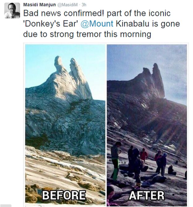
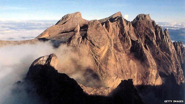
The earthquake was so powerful it also snapped off one of Mount Kinabalu's "Donkey's Ear" peaks.
The tourism minister for Sabah state said that 32 guides were assisting the climbers on their way down, with the group moving "cautiously due to (a) damaged trail".
"Other than ongoing rescue efforts, our priority is to send food, drinks and warm clothing to those still stranded on the mountain," he said.
Some of the group had climbed to the summit to watch the sunrise as the earthquake struck.
The US Geological Survey said the quake happened at around 07:15 local time (00:15 BST), at a depth of 10km (32,800ft). The epicentre was 54km (33 miles) from Mount Kinabalu, which stands at 4,095m.
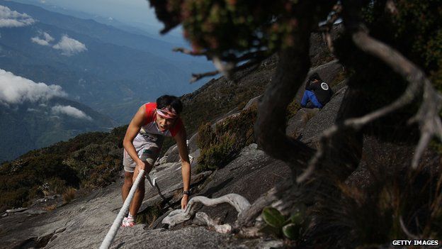
Many climbers are attracted to the challenging "via ferrata" climbing route, where cables, metal rungs and bridges are set into the rocks on the steep terrain to help people ascend.
All activity on the mountain has now been suspended.

Climbing Mt Kinabalu
- Climbing up and down Mt Kinabalu takes on average two days and one night. There are two trails - the Summit trail and the more advanced Mesilau trail
- The Summit trail begins at Timpohon Gate (1,800m; 5,906 ft)
- It takes about 6-8 hours to reach Laban Rata (3,273m; 10,738 ft) where climbers rest for a few hours
- They usually depart for the summit at 02:00 in the morning, reaching it 4-5 hours later before descending the mountain
Earlier, one person apparently trapped on the mountainside said on Facebook:"Currently we're waiting for the helicopter to save us.
"We cannot go down for now because there are lots of stones falling, there's no safe route down, and there are still tremors. Thank you for all your concern and prayers."
The woman identified herself as Charlene Dmp.
The quake also damaged roads and buildings, including schools and a hospital on Sabah's west coast.